
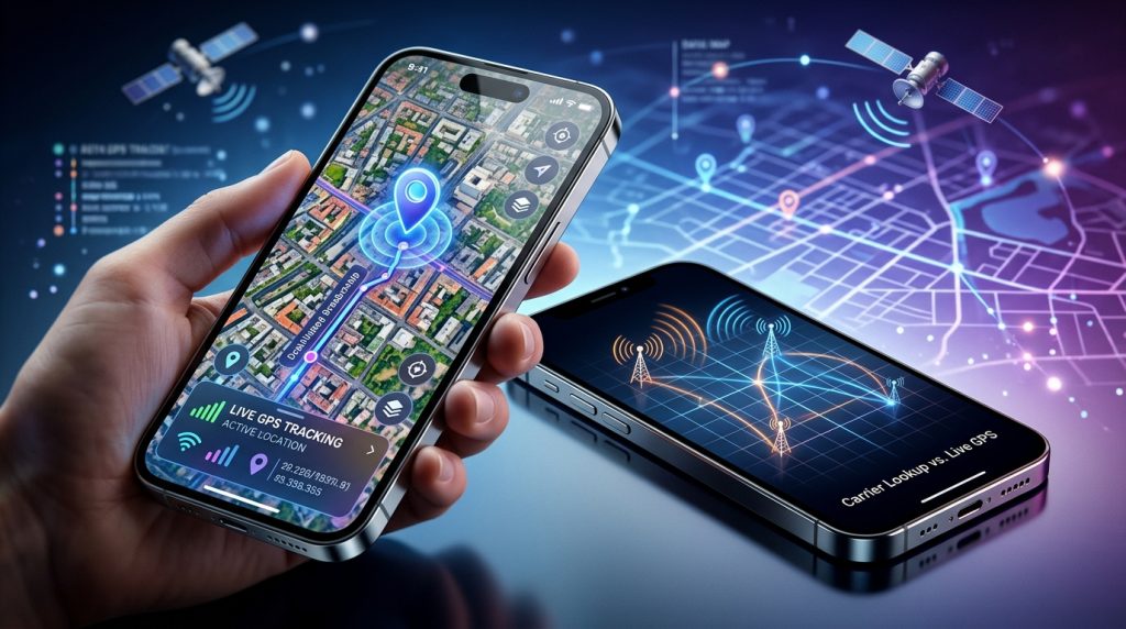
Few tech concepts are surrounded by as much misunderstanding as the idea of locating a smartphone using just its 10-digit number. Hollywood movies regularly depict investigators typing a mobile number into a glowing terminal and instantly zooming in on a blinking red dot moving down a crowded street. When a child fails to come home on time or a company vehicle goes missing, parents and business owners often wonder if a public phone tracker by number can really deliver that level of instant visibility.
The short answer is no—at least not in the way cinema portrays it. Entering a phone number into an online search box will not provide real-time satellite coordinates. However, true real-time location monitoring is entirely possible when you understand the underlying technology that bridges cellular identifiers, satellite navigation, and modern device-level software. Navigating this landscape requires separating marketing myths from technical realities so you can protect your family and manage organizational assets responsibly.
Whether you are setting safety boundaries for a new teen driver or coordinating field staff across multiple work sites, understanding the mechanics of location tracking helps you choose reliable tools, avoid online scams, and keep expectations grounded in how mobile networks actually operate.
The Reality Behind Tracking a Device by Number Alone
Every day, thousands of people search for ways to track a phone number online, hoping for a simple, zero-installation solution. This high demand has created an entire industry of reverse-lookup websites and deceptive utility portals that promise instant satellite tracking with a single click. Understanding why these claims fall flat requires a look at how telecommunications networks handle subscriber data.
Common Myths Versus Cellular Network Limitations
The primary myth is that a telephone number acts as a universal GPS beacon. In reality, a phone number—technically known as a Mobile Station International Subscriber Directory Number (MSISDN)—is merely a routing label within a carrier’s database. It instructs cellular switches where to direct voice calls and SMS packets. It does not broadcast an open geographic beacon to the wider internet.
When a handset communicates with cell towers, the network operator maintains internal records such as the Home Location Register (HLR) and Visitor Location Register (VLR). These records track which cellular base station is currently serving the SIM card so inbound calls can be routed efficiently. However, this connection data is strictly restricted:
- Carrier Security Walls: Cellular providers do not expose raw tower connection records to public web applications. Accessing these internal logs requires a court order, emergency 911 dispatch integration, or formal law enforcement warrants.
- Coarse Data Resolution: Even when a carrier checks tower association, the data usually indicates only that a phone is within the multi-mile coverage cone of a specific cell site sector, not its exact street address.
- SIM vs. Device Disconnect: A phone number is tied to a SIM card, not the handset’s physical satellite receiver. If the SIM is removed or roaming on partner networks, number-only queries yield zero usable geographic data.
Why Public Number Lookup Tools Deliver Outdated Data
If you have ever tested an online “instant phone locator,” you likely noticed that the results were either completely inaccurate or hidden behind a recurring subscription paywall. The Federal Trade Commission regularly warns consumers about automated directory schemes that promise private location intelligence but deliver basic public records instead.
These commercial lookup tools do not ping the device. Instead, they query legacy landline exchange directories, area-code allocation charts, and public marketing databases. At best, they return the city or municipality where the telephone exchange was originally registered. If someone moves from Chicago to Denver while keeping their original mobile number, a public reverse lookup will continue reporting Chicago indefinitely. For genuine safety and asset management, static directory lookups are functionally useless.
How Modern GPS Tracking Actually Works
To receive accurate, up-to-the-minute coordinates, the tracking process must interact directly with the operating system of the target device. Modern mobile operating systems combine multiple hardware sensors—a method known as hybrid positioning—to calculate precise location data before transmitting it securely to an administrative dashboard.
Understanding the difference between carrier-side approximations and on-device satellite tracking clarifies why professional monitoring tools depend on dedicated client software.
Carrier Triangulation vs. Dedicated GPS Tracking Software
When telecommunication engineers need to estimate a device’s position without on-board software, they rely on network triangulation. This involves measuring signal characteristics between three or more surrounding cellular towers:
- Cell-ID (CID): Identifies the single base station antenna communicating with the phone. In urban areas, precision might be within a few hundred meters; in rural settings, it can span several miles.
- Time Difference of Arrival (TDOA): Measures the nanosecond differences in how long a radio signal takes to reach multiple surrounding towers, calculating an intersecting geometric zone.
- Angle of Arrival (AoA): Evaluates the directional angle of the incoming mobile signal at the antenna array to narrow down the sector.
While triangulation is valuable for emergency services when no other telemetry exists, it is inherently imprecise indoors, in rugged terrain, or in sparsely populated rural corridors. In contrast, dedicated device-level monitoring software taps into the handset’s native location engine, integrating Global Navigation Satellite Systems (GNSS) such as GPS, GLONASS, Galileo, and BeiDou.
| Tracking Method | Accuracy Range | Installation Requirement | Real-Time Utility |
|---|---|---|---|
| Public Number Directory | City / Regional Level | None (Web-based) | None (Static historic records) |
| Carrier Tower Triangulation | 500m – 3,000m | Carrier Network Access | Moderate (Requires legal/emergency warrant) |
| Device-Level GPS Tracking | 2m – 10m | Direct App Setup | High (Instant live updates & route logs) |
How Device-Level Monitoring Delivers Pinpoint Data
When installed on an authorized phone, modern monitoring software operates by reading the device’s Location Services Application Programming Interface (API). This API blends satellite fixes with auxiliary positioning mechanisms:
- Assisted GPS (A-GPS): Downloads orbital satellite trajectory data via cellular connections, enabling the phone to lock onto satellite constellations in seconds rather than minutes.
- Wi-Fi Positioning System (WPS): Scans nearby Wi-Fi network Basic Service Set Identifiers (BSSIDs). Even without connecting to a router, matching nearby signal strengths against global access point maps provides indoor accuracy down to a specific room.
- Bluetooth Beacons & Dead Reckoning: Incorporates data from the phone’s internal accelerometer, gyroscope, and compass to maintain accurate positioning when traveling through tunnels or urban canyons where satellite visibility is obstructed.
The monitoring client packages these coordinates with precise timestamps, speed calculations, and horizontal accuracy estimations. It then transmits this payload over encrypted HTTPS channels to a secure cloud server, where it is visualized on an interactive map for authorized parents or business administrators.
Our engineering work at SPYERA began over two decades ago during the early days of mobile telecommunications. Over twenty-five years of designing monitoring architectures across evolving mobile platforms has shown that dependable location tracking consistently requires deep, native integration with the operating system rather than superficial web shortcuts.
Practical Use Cases: Child Safety and Fleet Management
Real-time location intelligence is not about constant surveillance; it is about establishing reliable safety nets and operational clarity. When deployed thoughtfully, modern tracking tools solve genuine safety challenges for families and operational headaches for business managers.
Ensuring Teen Driver Safety and Geofence Boundaries
Handing car keys to a teenager is a major milestone for any household. While it represents growing independence, road accidents remain one of the leading safety concerns for young drivers. Parents frequently use real-time GPS tracking to establish protective boundaries without resorting to intrusive phone calls while the teen is operating a vehicle.
A central capability in modern family digital safety tools is geofencing. Parents can draw virtual perimeters on a map around familiar locations such as schools, sports complexes, homes, and restricted neighborhoods. When the device crosses one of these invisible boundaries, the system sends an automated notification to the parent’s phone.
To implement balanced location safety for younger family members, consider this practical setup workflow:
- Establish Primary Safe Hubs: Create radial or polygon geofences around school, home, and regular extracurricular sites with a buffer zone of roughly 100 meters to avoid false boundary triggers.
- Review Transit Route Histories: Rather than watching a live map constantly, check historical route logs at the end of the week. Look for unexpected detours, unusual stop durations, or highway transit during severe weather.
- Integrate with Broader Protection: Location is only one aspect of mobile supervision. Parents often combine GPS monitoring with tools to protect family digital safety across social apps, messaging platforms, and browsing environments.
Protecting Company Assets and Verifying Field Operations
For commercial enterprises, managing a mobile workforce—such as HVAC technicians, delivery drivers, or on-site sales consultants—requires accurate field accountability. Deploying device-level location tracking on company-owned equipment helps organizations optimize dispatch routes, confirm arrival times for customer billing, and protect high-value hardware against loss or theft.
When an enterprise deploys specialized monitoring across its company-owned fleet, administrators can verify whether service appointments were fulfilled on schedule and prevent unauthorized off-hours vehicle use. If a company laptop or smartphone containing sensitive client information is misplaced, real-time location telemetry allows IT managers to locate the hardware swiftly and execute security protocols to safeguard against corporate data breaches and unauthorized access.
Key Features to Look for in a Comprehensive Location Tracker
Not all location monitoring software is built to the same engineering standards. Poorly optimized applications can cause rapid battery drain, trigger constant system warnings, or fail to report location updates when the screen is turned off. When evaluating solutions for family or workplace oversight, look for the following essential technical capabilities.
1. Adaptive Polling and Battery Optimization
Continuous satellite tracking requires substantial hardware power. If an application pings the GPS chip every three seconds continuously, the phone’s battery will deplete within hours, alerting the user and defeating the utility of the tool.
Advanced tracking software uses intelligent power-management algorithms:
- Stationary Sleep Mode: When the handset’s internal accelerometer detects no physical movement for a sustained period, the app reduces GPS polling frequency and relies on low-power cell tower checks.
- Motion-Triggered Polling: As soon as velocity or sustained motion is detected, the software increases sensor frequency to record high-resolution breadcrumb trails along roadways.
- Configurable Intervals: Administrators can manually set reporting frequencies—such as updating every 5, 10, or 30 minutes—to balance location precision against device battery longevity.
2. Cross-Platform Device Support
Households and corporate fleets are rarely homogeneous. A family might have parents using desktop workstations while children carry Android smartphones and iPads. A robust monitoring architecture must provide unified management across all major operating environments.
Whether you need a dedicated Android tracking client that functions smoothly alongside Google Play services or an iPhone monitoring solution tailored to iOS privacy architectures, ensure the platform aggregates all endpoint data into a single, accessible web dashboard.
3. Detailed Historical Route Logs with Sensor Metadata
A simple map pin showing where a phone is right now tells only part of the story. Comprehensive solutions store historical location telemetry over weeks or months, allowing you to reconstruct travel timelines with rich context:
- Exact arrival and departure timestamps for every visited location.
- Calculated travel speeds between route points to identify potential driving hazards.
- Street-level address reverse geocoding alongside raw latitude and longitude coordinates.
- Altitude, heading direction, and location accuracy metrics (in meters) for each logged point.
Step-by-Step: Evaluating and Implementing a Tracking Solution
Deploying a mobile tracking tool requires a systematic approach to ensure reliable data reporting and regulatory compliance. Follow this checklist when configuring a device for family protection or workforce management:
- Verify Device Compatibility and OS Permissions: Check that the target device’s operating system version is supported by the software. Ensure you have physical access to configure necessary background location permissions (such as selecting “Always Allow” rather than “Only While Using the App”).
- Calibrate Location Accuracy Settings: On Android devices, enable “Google Location Accuracy” (which uses Wi-Fi and cellular networks alongside GPS). On iOS, ensure “Precise Location” is toggled on within the system settings for the monitoring profile.
- Configure Battery Whitelisting: Modern operating systems aggressively close background processes to conserve power. Exclude the tracking software from system battery optimization managers (e.g., Device Care on Samsung or background app refresh limitations on iOS).
- Establish Administrative Geofences: Log into the web portal and configure primary safety zones, assigning immediate email or dashboard alerts for arrival and departure events.
- Perform a Live Field Test: Carry the configured device across a pre-planned route spanning known locations. Verify that the control panel logs the breadcrumbs accurately and triggers geofence alerts within expected timeframes.
Legal and Ethical Considerations in Phone Monitoring
Location tracking technology is powerful, and with that power comes significant legal and ethical responsibility. Misusing tracking tools can lead to severe civil liabilities, criminal charges, and lasting damage to personal or professional relationships. Maintaining clear boundaries is essential.
Parental Supervision of Minor Children
In almost all jurisdictions, parents and legal guardians have the legal right to monitor the digital devices and geographic locations of their minor children. Because parents are legally responsible for their children’s welfare and safety, installing monitoring software on a minor’s phone is widely recognized as a legitimate parenting practice.
However, digital safety experts agree that the technical implementation should be paired with open communication. As children enter their teenage years, explaining why a tracker is in place—framing it as an emergency safety net rather than an instrument of mistrust—fosters healthy digital habits. Discussing boundaries openly prepares young people to navigate digital privacy responsibly as they transition into adulthood.
Corporate Asset Tracking and Employee Consent
For business owners, the legal landscape surrounding mobile monitoring is governed by specific workplace privacy standards:
- Device Ownership: Employers generally have broad authority to monitor devices that are entirely owned, financed, and issued by the enterprise for professional duties.
- Clear Written Policies: A comprehensive Employee Acceptable Use Policy should explicitly state that company-provided devices are subject to location tracking, data logging, and performance auditing during working hours.
- Explicit Notice and Consent: In many jurisdictions, employees must sign an acknowledgment confirming they understand their movements may be logged while using company equipment. Secretly tracking an employee on their personal device (BYOD) without explicit consent is illegal.
- Off-Hours Privacy: Fleet tracking should ideally be restricted to scheduled business shifts, respecting employee privacy when company vehicles or phones are authorized for personal use during weekends or evenings.
Using monitoring technology responsibly ensures that safety and efficiency goals are met while fully respecting personal privacy and statutory regulations.
How SPYERA Can Help
SPYERA has helped parents and employers with phone tracker by number since 1999. Monitor calls, messages, locations, and app activity on Android, iPhone, Windows, and Mac — used responsibly, with consent, on devices you own or are authorized to monitor.
Frequently Asked Questions
Can civilians get real-time GPS location just from a phone number?
No. Entering a phone number into a website cannot return live, pinpoint GPS coordinates because cellular providers protect subscriber network data under privacy laws. Precise real-time tracking requires dedicated software installed on the device or direct authorization through platform-level location sharing.
What is the difference between cell tower triangulation and GPS tracking?
Cell tower triangulation estimates a phone’s position based on signal strength across nearby base stations, often with an error margin between 500 meters and several miles. GPS tracking connects directly with satellite constellations to pinpoint hardware coordinates within a few meters.
Do modern tracking tools drain the target device’s battery quickly?
Well-engineered monitoring software uses adaptive polling, which queries hardware sensors only during movement or at scheduled intervals. This significantly reduces power consumption compared to older continuous-ping methods.
Is it legal to track a company-owned mobile phone?
Yes, in most jurisdictions employers can track company-owned devices used by staff during working hours, provided there is a clear, written acceptable use policy and the employee has been properly notified or given consent.
Why do free phone number lookup websites only show a city or state?
Free lookup directories rely on public North American Numbering Plan (NANP) databases and telecommunication switch registration records. They only display the geographic area where the area code and prefix were originally issued, not where the physical handset is today.