
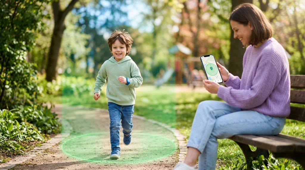
Your child just started walking home from school independently, taking public transit, or driving to their first after-school job. It marks a milestone in their growing independence—and an undeniable adjustment for your peace of mind. As a parent, you want to give them room to navigate the world without subjecting them to constant check-in texts that interrupt their day and fray their patience.
Part of our complete guide: Phone Monitoring Software: The Complete Guide
This is where modern location technology provides a practical middle ground. By using a reliable geofencing app for parents, you can establish automated virtual boundaries around the places your family frequents most: school campuses, sports complexes, home, and trusted friends’ houses. Rather than spending your afternoon refreshing a live map or making anxious phone calls, you receive immediate, background updates only when it matters—when your child arrives safely or leaves an approved area.
Understanding how virtual perimeters work, configuring them correctly to avoid false alarms, and introducing these tools constructively allows you to build a reliable safety net that respects your child’s developing autonomy.
What Is Geofencing and How Does It Protect Children?
At its foundation, geofencing is a location-based technology that uses global positioning satellites (GPS), Wi-Fi networks, and cellular tower data to draw an invisible perimeter around a specific physical location on a digital map. When a monitored mobile device crosses this predefined boundary—either entering or exiting—the software triggers an automated response, such as sending a push notification, logging a timestamp, or dispatching an email alert to the parent.
The Mechanics: GPS, Wi-Fi, and Cellular Triangulation
Modern mobile devices do not rely on a single sensor to determine where they are. To deliver dependable boundary monitoring without excessive battery drain, parental tracking software leverages three interconnected location layers:
- GPS Satellites: Provide precise outdoor positioning within a few meters by calculating time signals from multiple orbiting satellites.
- Wi-Fi Positioning: Identifies nearby wireless routers and access points to pinpoint locations inside buildings, multi-story schools, or dense commercial centers where satellite signals struggle to penetrate.
- Cellular Triangulation: Measures signal strength from surrounding cellular towers to maintain a baseline location estimate even when high-precision sensors are idle.
When these data streams combine, the software creates a continuous spatial awareness model. The system detects when the device coordinates transition from “inside” to “outside” a designated perimeter, instantly initiating your configured alert rules.
Replacing Constant Check-Ins with Automated Peace of Mind
Traditional safety routines often depend on manual check-in texts: “Text me when you get to soccer practice,” or “Let me know the second you reach Grandma’s.” In practice, kids forget, phone batteries run low, or conversations with friends take precedence. The ensuing silence often triggers unnecessary parental worry.
Automated boundary alerts remove human error from the equation. Because notifications fire automatically upon arrival or departure, you stay informed in real time while your child remains focused on their classes, practice, or social activities. It turns passive anxiety into structured, reliable awareness.
Key Benefits of Using a Geofencing App for Parents
Deploying dedicated safe zones delivers practical safety advantages that extend far beyond simply viewing a blue dot on a digital map.
1. Immediate Arrival and Departure Confirmation
The primary benefit of a parental geofencing setup is instant verification during routine daily transitions. You receive an alert the moment your child steps onto school grounds in the morning, departs for their walk home, or reaches an extracurricular venue. If practice finishes early or your teenager leaves a friend’s house ahead of schedule, you know immediately without needing to prompt them.
2. Monitoring Daily Commutes and Travel Corridors
For children who commute via bicycle, public transit, or on foot, travel windows carry the highest degree of unpredictability. Setting tight boundaries around the origin and destination points allows you to track travel duration accurately. If the journey between school and home typically takes 25 minutes, but an hour has elapsed without a “Home Arrival” notification, you can check the live tracking status immediately to ensure they have not run into transit delays or taken an unexpected detour.
3. Defining “No-Go” Zones and Hazardous Neighborhoods
Geofencing is not limited to safe harbors. Responsible parents can also establish exclusion zones—often called “no-go zones”—around areas that pose safety risks. These might include:
- Busy industrial parks, train yards, or highway overpasses near residential neighborhoods.
- Unsupervised public bodies of water, quarries, or construction sites.
- Specific neighborhoods or commercial venues your family has agreed are off-limits without adult supervision.
Should your child inadvertently wander toward or enter one of these zones, the application flags the event instantly, allowing you to intervene before a dangerous situation develops.
Essential Features to Look for in Parental Geofencing Software
Not all location monitoring tools offer the same level of precision and configurability. When evaluating software to safeguard your family, look for capabilities that address real-world parenting scenarios rather than basic consumer map sharing.
Customizable Radius and Boundary Geometries
A rigid circular radius does not always reflect real-world geography. While a simple 100-meter circle works well for a suburban home, a sprawling high school campus or an irregularly shaped park requires flexible boundary controls. Look for solutions that allow you to adjust radius sliders in fine increments or draw polygonal boundaries that match property lines precisely.
Intelligent Power Management
Continuous, high-frequency GPS pinging can rapidly drain a smartphone’s battery, leaving your child without a working phone when they need it most. High-grade software uses intelligent motion-sensing algorithms. The app sleeps when the device remains stationary within a safe zone and increases polling frequency only when the internal accelerometer detects sustained movement.
Historical Route Logs with Exact Timestamps
Real-time alerts tell you what is happening right now, but historical context is equally vital. Comprehensive parental tools maintain searchable location history logs. These logs allow you to review previous routes, check transit speeds, and confirm whether a commute followed agreed-upon paths over the past week or month.
Reliability Evaluation Checklist for Parents
Before committing to a safety platform, use this evaluation checklist to ensure the software meets your family’s operational needs:
- Multi-Platform Support: Does the service work consistently across both Android and iOS devices without feature degradation?
- Administrative Tamper Protection: Is the app protected against unauthorized uninstallation or permission revocation?
- Multi-Channel Alerting: Can you receive alerts via push notifications, email summaries, or dashboard logs simultaneously?
- Granular Sensitivity Settings: Can you widen the geofence buffer to prevent false alarms caused by natural GPS drift indoors?
How to Configure Location Alerts with SPYERA
Setting up dependable location boundaries requires robust software engineered for precision. Drawing on engineering expertise developed since 1999, SPYERA provides parents with comprehensive device management capabilities, combining high-resolution GPS tracking with an intuitive web control center designed to protect your family across every stage of their digital lives.
Follow these concrete steps to configure custom safe zones and automated alerts on your child’s phone:
Step 1: Install the Application on the Target Device
To begin, set up the monitoring software directly on the smartphone your child carries. Depending on your family’s hardware, install either the dedicated Android monitoring software or the tailored iPhone monitoring solution. Ensure you grant all necessary location permissions during setup, selecting “Allow All the Time” (or “Always Allow”) so the background service can monitor boundary crossings even when the screen is locked.
Step 2: Access the Web-Based Control Center
Once installation is complete, log in to your secure SPYERA dashboard from any web browser on your computer, tablet, or phone. Navigate to the Locations module on the main navigation sidebar, then select Geofencing from the submenu.
Step 3: Define Your Safe Zones and Restricted Areas
Inside the geofence management screen, you can create your designated perimeters:
- Click Add New Geofence on the map interface.
- Enter a specific street address in the search bar (for example, your child’s school: “742 Evergreen Terrace”) or manually drag the pin to center the marker.
- Assign a clear label to the zone, such as “Lincoln Middle School,” “Home,” or “Community Soccer Fields.”
- Adjust the radius slider. For a standard residential house, set a radius between 75 and 150 meters to account for indoor GPS drift. For large school campuses, expand the radius to 250–400 meters to encompass athletic fields and parking zones.
- Choose the fence type: designate it as a Safe Zone (where entry is expected) or a Restricted Zone (where entry triggers an immediate warning).
Step 4: Configure Trigger Conditions and Alert Channels
After defining the physical boundary, establish the notification criteria. You can specify whether you want to be alerted on Entry, Exit, or Both. Select your preferred delivery method—instant email alerts, dashboard event markers, or mobile notifications—and click Save. The rules synchronize with the target device immediately.
Balancing Digital Supervision with Your Child’s Privacy
Implementing tracking software is most effective when paired with open, age-appropriate communication. Technology provides the physical safety net, but conversation establishes the trust necessary for healthy digital development. Organizations like ConnectSafely emphasize that parental monitoring works best when children understand the intent behind safety boundaries.
Age-Appropriate Approaches to Location Boundaries
A child’s developmental stage should dictate how you frame and manage location tracking:
- Elementary and Middle School (Ages 8–13): Younger children generally understand safety rules in concrete terms. Explain that the geofence acts like a digital hand-hold: it lets you know they reached school safely without requiring them to call you while getting settled in class.
- High School and Teen Drivers (Ages 14–17): Teenagers value privacy and personal agency. Frame location tools as an enabler of independence rather than surveillance. For example: “Having this alert set up means I don’t need to text you every 30 minutes while you’re out with friends. As long as the safe zone confirms you’re where we agreed, I won’t interrupt your evening.”
The Family Digital Safety Agreement
Consider establishing a written or verbal family agreement before enabling location services. Outline clear expectations regarding where they can go, curfew hours, and what steps you will take if an unexpected boundary alert triggers. When children understand that the goal is physical protection and emergency readiness—not micromanagement—they are far more likely to cooperate with family safety policies.
Note on Lawful Use: Monitoring software is intended strictly for parents and legal guardians supervising minor children, or for businesses managing company-owned hardware with clear employee consent. Responsible, transparent use ensures that safety tools remain ethical, effective, and fully compliant with local regulations.
How SPYERA Can Help
SPYERA has helped parents and employers with geofencing app for parents since 1999. Monitor calls, messages, locations, and app activity on Android, iPhone, Windows, and Mac — used responsibly, with consent, on devices you own or are authorized to monitor.
Frequently Asked Questions
How accurate is geofencing on a child’s smartphone?
Under clear sky conditions with active GPS, mobile geofencing is accurate within 5 to 15 meters. Indoors or in dense urban areas, the system supplements satellite data with Wi-Fi positioning and cellular triangulation to maintain reliable boundary alerts.
Does running a geofencing app constantly drain the phone battery?
Modern location software balances accuracy with battery conservation by using dynamic polling. Instead of running full GPS continuously, the app monitors low-power cellular and Wi-Fi beacons, activating high-precision GPS only when significant movement is detected.
Can my child disable the location tracking or safe zone alerts?
Dedicated parental monitoring applications require administrative passcodes to uninstall or modify. While a child can toggle device-level location services off, robust software immediately logs the status change and alerts parents to the loss of tracking.
What is the recommended radius for a school or home safe zone?
A radius between 100 and 200 meters works best for most homes and neighborhood schools. This buffer accounts for standard GPS drift and prevents false entry or exit notifications while your child is simply in the backyard or waiting at the campus gate.
Is it legal to install a geofencing monitoring app on my teenager’s phone?
Yes, parents and legal guardians have the legal right to monitor the digital devices of minor children in their care. Transparency is strongly recommended, as discussing boundaries openly fosters trust while maintaining essential physical safety.